LOS ANGELES – A weather event called an atmospheric river event could bring heavy rain, strong winds, and snow to some parts of California. This could make things worse for people who have already been affected by the recent wildfires.
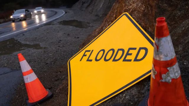
In areas where fires like the Eaton and Palisades in January left burn scars, officials warned residents on Tuesday to leave their homes because heavy rain could turn homes and businesses that survived the fires into mud holes.
Dr. Ariel Cohen, who is in charge of the National Weather Service office in the Los Angeles area, said that the storm could bring a lot of rain, especially to places that have been burned.

“We could make it through the system with minimal impact, but there’s also the possibility of significant debris flows, flooding and damaging wind gusts,” Cohen said.
Forecasts say that it could rain up to 4 inches over the last few days of the workweek. This could cause floods and mudslides.
Wildfire burn scars often cause mudslides and flooding because the land there doesn’t soak up water well, so water runs off.
People in Southern California are being told to stay alert by having more than one way to get tips in case things get worse quickly.

“Because of the high risk of flash flooding, debris flows, and mudslides, people should get ready to leave now.” “These dangers are very likely to cause harm to people and property,” Southern California officials warned in an evacuation alert.
The FOX Forecast Center says that the worst time for people to be outside will be later on Wednesday night and early Thursday morning, when it could rain up to an inch per hour.
Nearly 20 million people in the Golden State are under a Flood Watch because of the danger. This includes people who live in places like Santa Monica, Los Angeles, Oceanside, and San Diego.
Although it’s late in the season for atmospheric river events, people in the area said they’d take any rain they can get because California’s dry season usually starts in late spring.
Although the storm system is moving quickly forward, it may mean that less rain falls generally. However, Cohen warned that there would be times when it would rain heavily across the Los Angeles basin and beyond.

Along with a lot of rain, the snow level in the Sierra Nevada Mountains is expected to drop by a lot. At higher elevations, several inches to several feet of snow is predicted.
Forecast models say that up to 4 feet of snow could fall, which would help make the snowpack higher in places where it has been below average this season.
A busy storm pattern in March could help make up for these shortfalls and help the state’s water supply get back on track.
“While this storm will help with drought conditions, it will take more prolonged, consistent rainfall to truly alleviate the dry spell,” Cohen said. “The next few weeks could bring additional storms, but we must also be prepared for the possibility of more dry conditions later in the spring.”