A burst of intense heat is poised to sweep across the Northeast late this week, bringing temperatures high enough to potentially break daily records in multiple cities.
The brief but powerful surge will be fuelled by a section of a larger heat dome anchored over the Great Plains, which is forecast to shift eastward into the weekend. While late July is historically the hottest part of the year, meteorologists warn this event may push temperatures beyond typical seasonal norms.
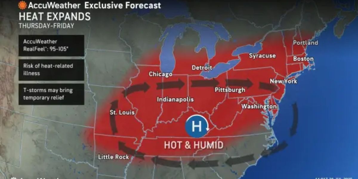
Heat Builds Thursday, Peaks Friday
Temperatures will begin to climb on Thursday, with widespread highs in the 80s and mid-90s expected across the Northeast. The peak of the heat is forecast for Friday, when several locations may either tie or surpass record highs.

“In Hartford, Connecticut, the current record of 98°F, set in 2001, may be topped,” said AccuWeather Senior Meteorologist Chad Merrill.
Meanwhile, New York City may tie its record high of 97°F, last set in 1999, and Boston is expected to approach or even beat its 1882 record of 96°F.
The high temperatures will be amplified by strong sunshine, warm Atlantic and lake waters, and extended daylight, all of which typically make late July one of the most oppressive times of year in the region.
Storms and Significant Cooldown Follow
Relief will arrive late Friday in the form of showers and heavy thunderstorms, which are expected to sweep across much of the region. As the storms move through, temperatures will tumble, with highs dropping to the upper 70s by Saturday across New England and parts of the Mid-Atlantic.

In addition to the cooldown, lower humidity will follow, bringing a welcome break from the sticky conditions. The drier air will first reach New England and northern Mid-Atlantic on Saturday and may push farther south along the Atlantic coast on Sunday, providing a brief reprieve before more typical summer conditions return.